|
|
|
|
Front
| Language: English |
| Map Scale: 1:2,500,000 |
|
| Item Identification Code (UID#): 5036 |
| Shelving Location: Maps: folded |
Log In to Edit this page
|
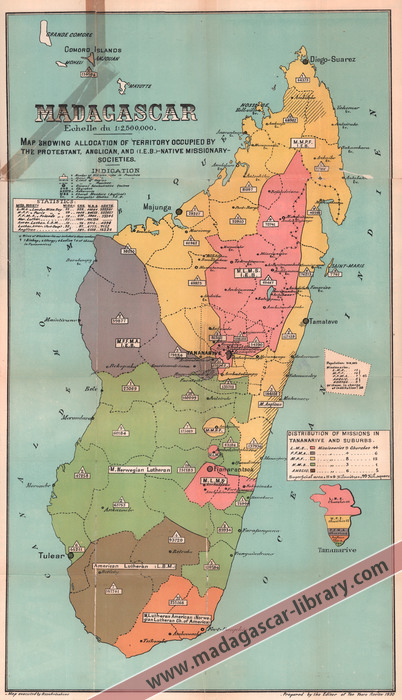
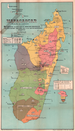
Madagascar
Map showing allocation of territory occupied by the Protestant, Anglican, and (IEB)-Native Missionary-Societies
|
|
|
Unknown (1930).
|
|
Folded Map
|
Categories
|
|
|
Acknowledgement
|
|
This item was kindly donated to the Madagascar Library collection by Andrew Carpenter.
|
|
BUY FROM AMAZON.COM
Browse 100s More Titles in our Madagascar Book Store
|
Photographs of the Item (Total: 1)
|
Click image to see larger:
 |
|
|
|
|
| Front |
|
|
|
|
|
|
© 2006–2025 Daniel Austin
|